
Go Back Through Toronto’s History Thanks To Side Walk Labs
Have you ever wondered what originally stood where your condo stands now? Well now you can find out.
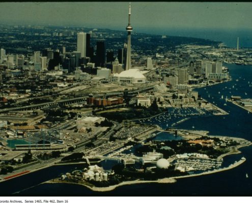
Earlier last week Google Sidewalk Labs revealed their project ‘Old Toronto’ (OLDTO). Inspired by web applications developed in San Francisco and New York, the website maps more than 30,000 photographs from the City of Toronto Archives. Extremely user-friendly, to use the tool all you need to do is search for a location and then browse through the archived images in that area. See below to check out what the area where our building is located originally looked like:
[envira-gallery id=”8896″]
In a statement released by Side Walk Labs they stated that they are also in the process of preparing OldTo for release as an open source tool, so local urban-tech enthusiasts can build on top of it. Engineers say they’re exploring additional features to add to the tool, including an aerial button that will “enable people to see how the city has changed from a birds-eye view”. Clicking on a photo will show any information contained in the description such as the title, date, conditions etc.
Try it out for yourself in the interactive map. (If you want to find us, we’re at 20 Bay Street)
If you’d like to work at such a historical location in Toronto, you can take a look at our available spaces.


Leave a Reply
Want to join the discussion?Feel free to contribute!